Geolocate

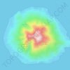
Gane Luar topographic map

Click on the map to display elevation.

About this map

Name: Gane Luar topographic map, elevation, terrain.

Location: Gane Luar, North Maluku, Maluku, Indonesia (-0.70101 128.37672 -0.66101 128.41672)

Average elevation: 0 ft

Minimum elevation: 0 ft

Maximum elevation: 0 ft

Other topographic maps

Click on a map to view its topography, its elevation and its terrain.

Pulau Gebe

Indonesia > North Maluku > Halmahera Tengah > Umera

Average elevation: 36 ft

Halmahera Timur

Indonesia > North Maluku

Average elevation: 571 ft

Tidore Kepulauan

Indonesia > North Maluku

Average elevation: 276 ft

Pulau Hiri

Indonesia > North Maluku > Ternate > Dorari Isa

Average elevation: 354 ft

Mandioli Island

Indonesia > North Maluku > Halmahera Selatan > Waya

Average elevation: 138 ft

Pulau Ternate

Indonesia > North Maluku > Ternate

Average elevation: 705 ft

Maba

Indonesia > North Maluku > Halmahera Timur

Average elevation: 23 ft

Mabasangaji

Indonesia > North Maluku > Halmahera Timur

Average elevation: 13 ft

Desa Waci

Indonesia > North Maluku > Halmahera Timur

Average elevation: 30 ft

Moti Island

Indonesia > North Maluku > Ternate

Average elevation: 479 ft

Pulau Batu

Indonesia > North Maluku > Pulau Taliabu

Average elevation: 102 ft

Gear up for your next adventure:

🪶Thermal Camp Blanket - Extra warmth for cold nights
🦺Reflective Outdoor Gear - Safety gear for low‑light conditions
🔥Fast-Boil Camping Stoves - Efficient cooking systems for quick trail meals
🎒Trail Energy Bars - High‑calorie bars for hiking energy
🚪Portable Camp Chair - Foldable chair for comfort at camp

As an Amazon Associate, this site earns from qualifying purchases at no extra cost to you.