
翟家所镇 topographic map
Interactive map
Click on the map to display elevation.
About this map
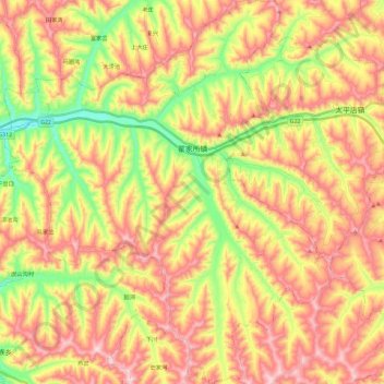
Name: 翟家所镇 topographic map, elevation, terrain.
Location: 翟家所镇, 会宁县, 白银市, 甘肃省, 中国 (35.57298 105.14510 35.76087 105.34306)
Average elevation: 6,539 ft
Minimum elevation: 5,797 ft
Maximum elevation: 7,205 ft
Other topographic maps
Click on a map to view its topography, its elevation and its terrain.