Geolocate

Ogilvie Ridge topographic map

Click on the map to display elevation.

About this map

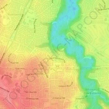
Name: Ogilvie Ridge topographic map, elevation, terrain.

Location: Ogilvie Ridge, Riverbend, Division No. 11, Alberta, T6R 2A1, Canada (53.46132 -113.57501 53.46852 -113.55317)

Average elevation: 2,208 ft

Minimum elevation: 2,064 ft

Maximum elevation: 2,310 ft

Other topographic maps

Click on a map to view its topography, its elevation and its terrain.

Big Lake

Canada > Alberta > Division No. 11 > St. Albert

Average elevation: 2,195 ft

Pigeon Lake

Canada > Alberta > Division No. 11 > Hamlet of Westerose

Average elevation: 2,838 ft

Thorncliff Park

Canada > Alberta > Division No. 11 > Edmonton

Average elevation: 2,221 ft

Saunders Lake

Canada > Alberta > Division No. 11

Average elevation: 2,365 ft

Westerose

Canada > Alberta > Division No. 11

Average elevation: 2,822 ft

Paul Kane Park

Canada > Alberta > Division No. 11 > Edmonton

Average elevation: 2,149 ft

Central McDougall Park

Canada > Alberta > Division No. 11 > Edmonton

Average elevation: 2,185 ft

Gear up for your next adventure:

🪓Survival Multi‑Tool - Versatile tool for camp and trail tasks
☀️Outdoor Sunscreen - High protection sunscreen for outdoor activities
🌄Hiking Binoculars - Compact binoculars for scenic views and trail spotting
🔭Compact Binoculars - HD vision for scouting terrain and identifying distant landmarks
🔦LED Headlamp - Bright and durable LED headlamp for night navigation

As an Amazon Associate, this site earns from qualifying purchases at no extra cost to you.