Geolocate

Dees topographic map

Click on the map to display elevation.

About this map

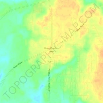
Name: Dees topographic map, elevation, terrain.

Location: Dees, Mobile County, Alabama, United States (30.54408 -88.36334 30.58408 -88.32334)

Average elevation: 108 ft

Minimum elevation: 49 ft

Maximum elevation: 151 ft

Mobile County trails, hiking, mountain biking, running and outdoor activities

Other topographic maps

Click on a map to view its topography, its elevation and its terrain.

Dauphin Island

United States > Alabama > Mobile County

Average elevation: 0 ft

Bayou La Batre

United States > Alabama > Mobile County

Average elevation: 30 ft

Citronelle

United States > Alabama > Mobile County

Average elevation: 226 ft

Mobile Bay

United States > Alabama > Mobile County

Average elevation: 39 ft

Grand Bay

United States > Alabama > Mobile County

Average elevation: 72 ft

Chickasaw

United States > Alabama > Mobile County

Average elevation: 20 ft

Satsuma

United States > Alabama > Mobile County

Average elevation: 23 ft

Creola

United States > Alabama > Mobile County

Average elevation: 36 ft

Mount Vernon

United States > Alabama > Mobile County

Average elevation: 59 ft

Spanish River

United States > Alabama > Mobile County > Mobile

Average elevation: 10 ft

Gear up for your next adventure:

📶Vehicle Signal Boosters - Improve reception in rural areas while driving to trailheads
🪶LED Camping Lantern - Bright lantern for camp lighting
🥾Hiking Shoes - Durable and comfortable shoes for trail hiking
🛶Inflatable Kayak - Portable kayak for rivers, lakes, and expeditions
🌲Outdoor Survival Books - Best books on survival skills

As an Amazon Associate, this site earns from qualifying purchases at no extra cost to you.