Geolocate

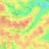
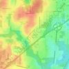
Grand Bay topographic map

Click on the map to display elevation.

About this map

Name: Grand Bay topographic map, elevation, terrain.

Location: Grand Bay, Mobile County, Alabama, United States (30.45083 -88.38774 30.49360 -88.30958)

Average elevation: 72 ft

Minimum elevation: 7 ft

Maximum elevation: 144 ft

Mobile County trails, hiking, mountain biking, running and outdoor activities

Other topographic maps

Click on a map to view its topography, its elevation and its terrain.

Bayou La Batre

United States > Alabama > Mobile County

Average elevation: 30 ft

West Hill

United States > Alabama > Mobile County > Mobile

Average elevation: 180 ft

Magazine

United States > Alabama > Mobile County > Mobile

Average elevation: 20 ft

Todd Acres

United States > Alabama > Mobile County > Mobile > Todd Acres

Average elevation: 20 ft

Park Forest

United States > Alabama > Mobile County > Mobile > Park Forest

Average elevation: 177 ft

Citronelle

United States > Alabama > Mobile County

Average elevation: 226 ft

Cloverdale

United States > Alabama > Mobile County

Average elevation: 43 ft

Mobile Bay

United States > Alabama > Mobile County

Average elevation: 39 ft

Neely

United States > Alabama > Mobile County > Prichard

Average elevation: 43 ft

Cambridge Estates

United States > Alabama > Mobile County > Mobile

Average elevation: 141 ft

Chunchula

United States > Alabama > Mobile County

Average elevation: 118 ft

Dees

United States > Alabama > Mobile County

Average elevation: 108 ft

Quail Run

United States > Alabama > Mobile County > Tillmans Corner

Average elevation: 115 ft

Satsuma

United States > Alabama > Mobile County

Average elevation: 23 ft

Norwood

United States > Alabama > Mobile County > Chickasaw

Average elevation: 26 ft

Gulf Dale

United States > Alabama > Mobile County > Mobile

Average elevation: 23 ft

Gear up for your next adventure:

🌡️Handheld Weather Meters - Measure wind, temp, and pressure for safe mountain travel
🔭Telescopic Hiking Pole - Adjustable pole for hiking stability
📚Navigation Handbooks - Master the art of reading topographic maps and using a compass
🪶Thermal Camp Blanket - Extra warmth for cold nights
📶Satellite Messenger - Communication device off‑grid

As an Amazon Associate, this site earns from qualifying purchases at no extra cost to you.