
Citronelle topographic map
Click on the map to display elevation.
About this map
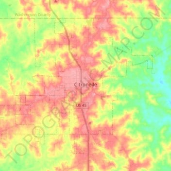
Name: Citronelle topographic map, elevation, terrain.
Location: Citronelle, Mobile County, Alabama, 36522, United States (31.04141 -88.32607 31.14403 -88.16421)
Average elevation: 226 ft
Minimum elevation: 69 ft
Maximum elevation: 361 ft
Mobile County trails, hiking, mountain biking, running and outdoor activities
Other topographic maps
Click on a map to view its topography, its elevation and its terrain.