
Cedron topographic map
Click on the map to display elevation.
About this map
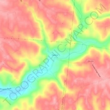
Name: Cedron topographic map, elevation, terrain.
Average elevation: 748 ft
Minimum elevation: 486 ft
Maximum elevation: 896 ft
Clermont County trails, hiking, mountain biking, running and outdoor activities
Other topographic maps
Click on a map to view its topography, its elevation and its terrain.
Locust Corner Park
United States > Ohio > Clermont County > Cincinnati > Locust Corner
Average elevation: 830 ft