Geolocate

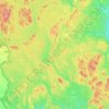
Harvey Rural Community topographic map

Click on the map to display elevation.

About this map

Name: Harvey Rural Community topographic map, elevation, terrain.

Location: Harvey Rural Community, York County, New Brunswick, Canada (45.50068 -67.23552 45.92706 -66.86367)

Average elevation: 433 ft

Minimum elevation: 92 ft

Maximum elevation: 1,017 ft

Other topographic maps

Click on a map to view its topography, its elevation and its terrain.

Durham Bridge

Canada > New Brunswick > York County > Durham Bridge

Average elevation: 266 ft

McGivney

Canada > New Brunswick > York County > McGivney

Average elevation: 587 ft

Douglas

Canada > New Brunswick > York County > Fredericton

Average elevation: 157 ft

Kingsclear

Canada > New Brunswick > York County

Average elevation: 249 ft

Kingsclear

Canada > New Brunswick > York County

Average elevation: 249 ft

Gear up for your next adventure:

🌧️Backpack Rain Cover - Keep gear dry in wet weather
🔊Portable Camp Speaker - Music and alerts at camp
🧺Microfiber Travel Towels - Compact and fast-drying towels for trail use
🗺️NatGeo Topo Maps - High-quality waterproof printed topographic maps of US Parks
👓Polarized Sunglasses - Outdoor sunglasses for glare reduction

As an Amazon Associate, this site earns from qualifying purchases at no extra cost to you.