
山阳县 topographic map
Interactive map
Click on the map to display elevation.
About this map
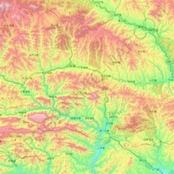
Name: 山阳县 topographic map, elevation, terrain.
Location: 山阳县, 商洛市, 陕西省, 中国 (33.16077 109.54015 33.70558 110.49648)
Average elevation: 3,238 ft
Minimum elevation: 837 ft
Maximum elevation: 6,929 ft
Other topographic maps
Click on a map to view its topography, its elevation and its terrain.