Geolocate

东川镇 topographic map

Interactive map

Click on the map to display elevation.

About this map

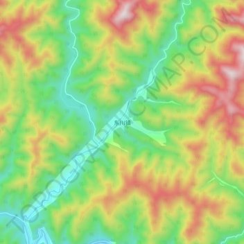
Name: 东川镇 topographic map, elevation, terrain.

Location: 东川镇, 商洛市, 陕西省, 中国 (33.50563 108.81022 33.58563 108.89022)

Average elevation: 3,077 ft

Minimum elevation: 1,739 ft

Maximum elevation: 5,020 ft

Other topographic maps

Click on a map to view its topography, its elevation and its terrain.

月日

中国 > 陕西省 > 商洛市

月日, 商洛市, 陕西省, 中国

Average elevation: 2,283 ft

黑龙口镇

中国 > 陕西省 > 商洛市

黑龙口镇, 商洛市, 陕西省, 中国

Average elevation: 3,399 ft

柞水县

中国 > 陕西省 > 商洛市

柞水县, 商洛市, 陕西省, 中国

Average elevation: 4,331 ft

丹凤县

中国 > 陕西省 > 商洛市

丹凤县, 商洛市, 陕西省, 中国

Average elevation: 3,146 ft

镇安县

中国 > 陕西省 > 商洛市

镇安县, 商洛市, 陕西省, 中国

Average elevation: 3,960 ft

洛南县

中国 > 陕西省 > 商洛市

洛南县, 商洛市, 陕西省, 中国

Average elevation: 3,812 ft

山阳县

中国 > 陕西省 > 商洛市

山阳县, 商洛市, 陕西省, 中国

Average elevation: 3,238 ft