
镇安县 topographic map
Interactive map
Click on the map to display elevation.
About this map
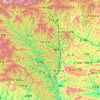
Name: 镇安县 topographic map, elevation, terrain.
Location: 镇安县, 商洛市, 陕西省, 中国 (33.12981 108.56485 33.70024 109.62002)
Average elevation: 3,960 ft
Minimum elevation: 974 ft
Maximum elevation: 9,816 ft
Other topographic maps
Click on a map to view its topography, its elevation and its terrain.