Geolocate

Banner topographic map

Click on the map to display elevation.

About this map

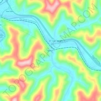
Name: Banner topographic map, elevation, terrain.

Location: Banner, Floyd County, Kentucky, 41603, United States (37.57927 -82.72127 37.61927 -82.68127)

Average elevation: 912 ft

Minimum elevation: 610 ft

Maximum elevation: 1,437 ft

Floyd County trails, hiking, mountain biking, running and outdoor activities

Other topographic maps

Click on a map to view its topography, its elevation and its terrain.

Wheelwright

United States > Kentucky > Floyd County

Average elevation: 1,460 ft

Allen

United States > Kentucky > Floyd County

Average elevation: 856 ft

Martin

United States > Kentucky > Floyd County

Average elevation: 883 ft

Gear up for your next adventure:

Camping Coffee Makers - Enjoy premium coffee at the summit or campsite
🎒Outdoor Daypacks - Lightweight backpacks designed for carrying maps and essential gear
📡GPS Antenna Upgrade - Enhance GPS reception in remote terrain
🚁Photography Drones - Capture stunning aerial views of landforms and topography
🛠️Outdoor Gear Repair Kit - Essential tools to fix gear on the trail

As an Amazon Associate, this site earns from qualifying purchases at no extra cost to you.