Geolocate

Wheelwright topographic map

Click on the map to display elevation.

About this map

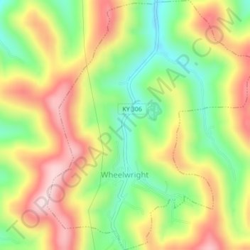
Name: Wheelwright topographic map, elevation, terrain.

Location: Wheelwright, Floyd County, Kentucky, 41669, United States (37.32424 -82.73182 37.35189 -82.70331)

Average elevation: 1,460 ft

Minimum elevation: 971 ft

Maximum elevation: 1,982 ft

Floyd County trails, hiking, mountain biking, running and outdoor activities

Other topographic maps

Click on a map to view its topography, its elevation and its terrain.

Bosco

United States > Kentucky > Floyd County

Average elevation: 932 ft

Teaberry

United States > Kentucky > Floyd County

Average elevation: 1,296 ft

Melvin

United States > Kentucky > Floyd County

Average elevation: 1,411 ft

Printer

United States > Kentucky > Floyd County

Average elevation: 971 ft

Stanville

United States > Kentucky > Floyd County

Average elevation: 922 ft

Hueysville

United States > Kentucky > Floyd County

Average elevation: 945 ft

Ivel

United States > Kentucky > Floyd County

Average elevation: 925 ft

Hi Hat

United States > Kentucky > Floyd County

Average elevation: 1,257 ft

Garrett

United States > Kentucky > Floyd County

Average elevation: 958 ft

Drift

United States > Kentucky > Floyd County

Average elevation: 1,024 ft

David

United States > Kentucky > Floyd County

Average elevation: 1,070 ft

Dana

United States > Kentucky > Floyd County

Average elevation: 1,056 ft

Bypro

United States > Kentucky > Floyd County

Average elevation: 1,309 ft

Beaver

United States > Kentucky > Floyd County

Average elevation: 1,453 ft

Banner

United States > Kentucky > Floyd County

Average elevation: 912 ft

Dwale

United States > Kentucky > Floyd County

Average elevation: 886 ft

Betsy Layne

United States > Kentucky > Floyd County

Average elevation: 886 ft

McDowell

United States > Kentucky > Floyd County

Average elevation: 1,063 ft

Ligon

United States > Kentucky > Floyd County

Average elevation: 1,480 ft

Blue River

United States > Kentucky > Floyd County

Average elevation: 909 ft

Weeksbury

United States > Kentucky > Floyd County

Average elevation: 1,598 ft

Minnie

United States > Kentucky > Floyd County

Average elevation: 1,037 ft

Dema

United States > Kentucky > Floyd County

Average elevation: 1,165 ft

Welco Station

United States > Kentucky > Floyd County

Average elevation: 948 ft

Gear up for your next adventure:

🧭Map Reading Tools - Tools and kits for map navigation
📱Heavy-Duty Phone Cases - Drop-proof and waterproof protection for outdoor navigation
🚗GPS Dash Cams - Record your scenic drives through mountain passes and canyons
🛡️Bear Spray Outdoor - Protection in bear country hikes
🌄Hiking Binoculars - Compact binoculars for scenic views and trail spotting

As an Amazon Associate, this site earns from qualifying purchases at no extra cost to you.