Geolocate

Godfrey topographic map

Click on the map to display elevation.

About this map

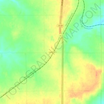
Name: Godfrey topographic map, elevation, terrain.

Location: Godfrey, Bourbon County, Kansas, United States (37.74171 -94.72996 37.78171 -94.68996)

Average elevation: 942 ft

Minimum elevation: 873 ft

Maximum elevation: 997 ft

Bourbon County trails, hiking, mountain biking, running and outdoor activities

Other topographic maps

Click on a map to view its topography, its elevation and its terrain.

Mapleton

United States > Kansas > Bourbon County

Average elevation: 876 ft

Redfield

United States > Kansas > Bourbon County

Average elevation: 863 ft

Fulton

United States > Kansas > Bourbon County

Average elevation: 827 ft

Bronson

United States > Kansas > Bourbon County

Average elevation: 1,060 ft

Gear up for your next adventure:

🔦LED Headlamp - Bright and durable LED headlamp for night navigation
🧣Merino Neck Gaiters - Multi-functional headwear for wind and sun protection
🪶Wildlife Field Guides - Learn animal tracking and species ID
📦Dry Bags Set - Waterproof storage for electronics and clothes
🕶️Glacier Sunglasses - Side shields to protect eyes from high-altitude snow glare

As an Amazon Associate, this site earns from qualifying purchases at no extra cost to you.