Geolocate

Satima topographic map

Interactive map

Click on the map to display elevation.

About this map

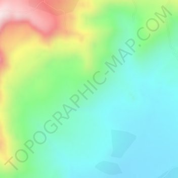
Name: Satima topographic map, elevation, terrain.

Location: Satima, West-Godscham, Amhara, Äthiopien (10.94000 37.19000 10.96000 37.21000)

Average elevation: 8,406 ft

Minimum elevation: 7,890 ft

Maximum elevation: 9,452 ft

Other topographic maps

Click on a map to view its topography, its elevation and its terrain.

ደባርቅ

Äthiopien > Amhara

ደባርቅ, Nord-Gonder, Amhara, Äthiopien

Average elevation: 9,275 ft

Manu

Äthiopien > Amhara

Manu, Nord-Gonder, Amhara, Äthiopien

Average elevation: 3,468 ft

Kone ?

Äthiopien > Amhara

Kone ?, North Shewa (Amhara Region), Amhara, Äthiopien

Average elevation: 4,262 ft

North Shewa (Amhara Region)

Äthiopien > Amhara

North Shewa (Amhara Region), Amhara, Äthiopien

Average elevation: 5,932 ft

Macanna

Äthiopien > Amhara > Macanna

Macanna, Nord-Gonder, Amhara, Äthiopien

Average elevation: 11,345 ft

Gojam

Äthiopien > Amhara

Gojam, Oromia, Amhara, Äthiopien

Average elevation: 5,768 ft