
Rocky Face topographic map
Click on the map to display elevation.
About this map
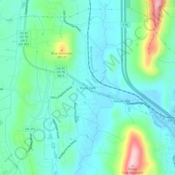
Name: Rocky Face topographic map, elevation, terrain.
Location: Rocky Face, Whitfield County, Georgia, 30740, United States (34.78508 -85.04745 34.82508 -85.00745)
Average elevation: 912 ft
Minimum elevation: 719 ft
Maximum elevation: 1,588 ft
Whitfield County trails, hiking, mountain biking, running and outdoor activities
Other topographic maps
Click on a map to view its topography, its elevation and its terrain.
Potato Hill Civil War Battlefield Park
United States > Georgia > Whitfield County > Dalton
Average elevation: 843 ft