Geolocate

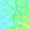
Tambubong topographic map

Click on the map to display elevation.

About this map

Name: Tambubong topographic map, elevation, terrain.

Location: Tambubong, San Rafael, Bulacan, Central Luzon, 3008, Philippines (14.96145 120.91494 14.97797 120.93373)

Average elevation: 59 ft

Minimum elevation: 23 ft

Maximum elevation: 92 ft

Other topographic maps

Click on a map to view its topography, its elevation and its terrain.
Diliman I

Philippines > Bulacan > San Rafael

Average elevation: 82 ft

Purok 3

Philippines > Bulacan > San Rafael

Average elevation: 62 ft

Tukod

Philippines > Bulacan > San Rafael

Average elevation: 259 ft

Mabalas-balas

Philippines > Bulacan > San Rafael

Average elevation: 75 ft

Lico

Philippines > Bulacan > San Rafael > Lico

Average elevation: 85 ft

Dagat-dagatan

Philippines > Bulacan > San Rafael > Dagat-dagatan

Average elevation: 46 ft

Pulong Bayabas

Philippines > Bulacan > San Rafael

Average elevation: 39 ft

Maronquillo

Philippines > Bulacan > San Rafael

Average elevation: 128 ft

Sapang Pahalang

Philippines > Bulacan > San Rafael

Average elevation: 236 ft

Coral na Bato

Philippines > Bulacan > San Rafael

Average elevation: 138 ft

San Agustin

Philippines > Bulacan > San Rafael

Average elevation: 56 ft

Cruz na Daan

Philippines > Bulacan > San Rafael > Cruz na Daan

Average elevation: 62 ft

Dagat-dagatan

Philippines > Bulacan > San Rafael

Average elevation: 46 ft

Tukod

Philippines > Bulacan > San Rafael

Average elevation: 259 ft

Gear up for your next adventure:

🧭Hiking Compass - Precision compass for reliable navigation in the wilderness
📱Solar Portable Charger - Solar power bank for charging devices off‑grid
🏕️Tent Footprint - Protect your tent base from wear
📶Satellite Messenger - Communication device off‑grid
🪶Multi‑Purpose Knife - Useful blade for camp and trail

As an Amazon Associate, this site earns from qualifying purchases at no extra cost to you.