Geolocate

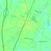
Westover II topographic map

Click on the map to display elevation.

About this map

Name: Westover II topographic map, elevation, terrain.

Location: Westover II, Wayne County, North Carolina, 27530, United States (35.38405 -78.06582 35.42405 -78.02582)

Average elevation: 108 ft

Minimum elevation: 59 ft

Maximum elevation: 151 ft

Wayne County trails, hiking, mountain biking, running and outdoor activities

Other topographic maps

Click on a map to view its topography, its elevation and its terrain.
Fremont

United States > North Carolina > Wayne County

Average elevation: 144 ft

Goldsboro

United States > North Carolina > Wayne County

Average elevation: 108 ft

Pikeville

United States > North Carolina > Wayne County

Average elevation: 138 ft

Goldsboro

United States > North Carolina > Wayne County

Average elevation: 108 ft

Goldsboro

United States > North Carolina > Wayne County

Average elevation: 108 ft

Gear up for your next adventure:

🗺️Topographic Maps - Detailed topo maps for hiking, exploring and outdoor navigation
🛡️Bear Spray Outdoor - Protection in bear country hikes
❄️Traction Cleats - Prevent slips on icy trails during winter hikes
📱Solar Portable Charger - Solar power bank for charging devices off‑grid
🔥Plasma Lighters - Windproof lighters that work in any weather condition

As an Amazon Associate, this site earns from qualifying purchases at no extra cost to you.