
Saug River topographic map
Click on the map to display elevation.
About this map
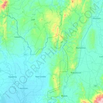
Name: Saug River topographic map, elevation, terrain.
Location: Saug River, Davao del Norte, Davao Region, Philippines (7.47817 125.75258 7.89742 125.98714)
Average elevation: 440 ft
Minimum elevation: 26 ft
Maximum elevation: 3,241 ft
Other topographic maps
Click on a map to view its topography, its elevation and its terrain.
Tagum
Philippines > Davao del Norte > Tagum
One of the significant accomplishments of the officialdom of Tagum during the 1990s was its elevation from a second to the first-class municipality. This opened a gateway to increase its financial resources through the Internal Revenue Allocation (IRA) from the national government and local revenues. This was…
Average elevation: 338 ft
Faith Tabernacle Church Sto. Tomas
Philippines > Davao del Norte > Santo Tomas
Average elevation: 118 ft