

Hervás topographic map
Click on the map to display elevation.
About this map
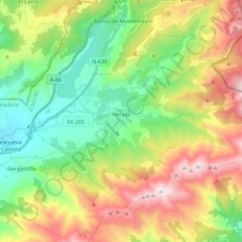
Name: Hervás topographic map, elevation, terrain.
Location: Hervás, Cáceres, Extremadura, 10700, Spain (40.22895 -5.91293 40.31193 -5.76343)
Average elevation: 3,337 ft
Minimum elevation: 1,634 ft
Maximum elevation: 6,050 ft
Other topographic maps
Click on a map to view its topography, its elevation and its terrain.

Parque Municipal Villafranco del Guadiana
Spain > Extremadura > Badajoz > Villafranco del Guadiana
Average elevation: 607 ft






El Caño de los Morón
Spain > Extremadura > Sierra Suroeste > Higuera la Real
Average elevation: 1,969 ft
Castillo de Piedrabuena
Spain > Extremadura > Tierra de Badajoz > San Vicente de Alcántara > Dehesa Piedrabuena
Average elevation: 1,194 ft