
大溪乡 topographic map
Interactive map
Click on the map to display elevation.
About this map
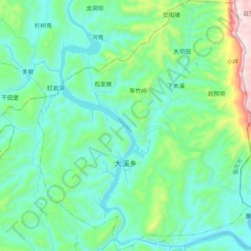
Name: 大溪乡 topographic map, elevation, terrain.
Location: 大溪乡, 秀山土家族苗族自治县, 渝东南武陵山区城镇群, 重庆市, 中国 (28.75487 109.11690 28.88416 109.24270)
Average elevation: 1,522 ft
Minimum elevation: 794 ft
Maximum elevation: 4,478 ft
Other topographic maps
Click on a map to view its topography, its elevation and its terrain.