
Pensacola Beach topographic map
Interactive map
Click on the map to display elevation.
About this map
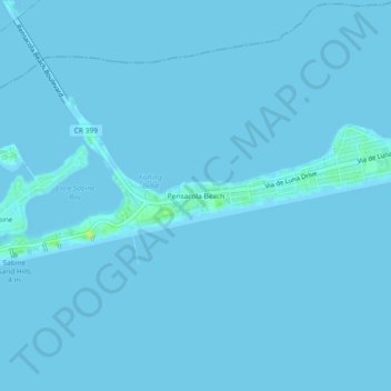
Name: Pensacola Beach topographic map, elevation, terrain.
Average elevation: 0 ft
Minimum elevation: -3 ft
Maximum elevation: 56 ft
Other topographic maps
Click on a map to view its topography, its elevation and its terrain.
Pensacola
United States > Florida > Escambia County
Pensacola, Escambia County, Florida, United States
Average elevation: 69 ft
Warrington
United States > Florida > Escambia County > Navy Point
Warrington, Navy Point, Escambia County, Florida, United States
Average elevation: 30 ft
Molino
United States > Florida > Escambia County
Molino, Escambia County, Florida, United States
Average elevation: 85 ft
Bohemia
United States > Florida > Escambia County > Pensacola
Bohemia, Pensacola, Escambia County, Florida, 32504, United States
Average elevation: 49 ft
Brownsville
United States > Florida > Escambia County
Brownsville, Escambia County, Florida, 32501, United States
Average elevation: 69 ft
Cantonment
United States > Florida > Escambia County
Cantonment, Escambia County, Florida, 32533, United States
Average elevation: 125 ft
Pensacola
United States > Florida > Escambia County > Pensacola
Pensacola, Escambia County, Florida, 32501, United States
Average elevation: 30 ft
Walnut Hill
United States > Florida > Escambia County
Walnut Hill, Escambia County, Florida, United States
Average elevation: 243 ft
Ensley
United States > Florida > Escambia County > Ensley
Ensley, Escambia County, Florida, United States
Average elevation: 115 ft
East Pensacola Heights
United States > Florida > Escambia County > Pensacola
East Pensacola Heights, Pensacola, Escambia County, Florida, 32520, United States
Average elevation: 26 ft
Beulah
United States > Florida > Escambia County
Beulah, Escambia County, Florida, United States
Average elevation: 95 ft
Gonzalez
United States > Florida > Escambia County > Gonzalez
Gonzalez, Escambia County, Florida, United States
Average elevation: 92 ft
Gull Point
United States > Florida > Escambia County > Pensacola > Gull Point
Gull Point, Pensacola, Escambia County, Florida, 32504, United States
Average elevation: 33 ft
Myrtle Grove
United States > Florida > Escambia County > Myrtle Grove
Myrtle Grove, Escambia County, Florida, United States
Average elevation: 43 ft
Century
United States > Florida > Escambia County
Century, Escambia County, Florida, United States
Average elevation: 102 ft
West Pensacola
United States > Florida > Escambia County > Pensacola
West Pensacola, Pensacola, Escambia County, Florida, United States
Average elevation: 66 ft
Ensley
United States > Florida > Escambia County > Ensley
Ensley, Escambia County, Florida, 32534, United States
Average elevation: 115 ft