
王家庄 topographic map
Interactive map
Click on the map to display elevation.
About this map
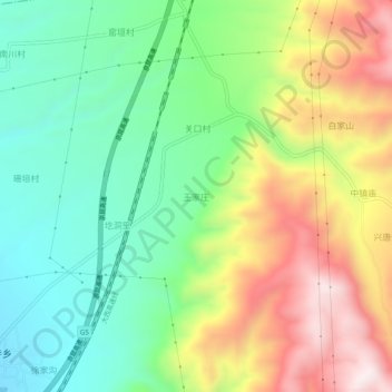
Name: 王家庄 topographic map, elevation, terrain.
Location: 王家庄, 洪洞县, 临汾市, 山西省, 中国 (36.41356 111.77291 36.45356 111.81291)
Average elevation: 3,297 ft
Minimum elevation: 2,490 ft
Maximum elevation: 4,531 ft
Other topographic maps
Click on a map to view its topography, its elevation and its terrain.