
三滩镇 topographic map
Interactive map
Click on the map to display elevation.
About this map
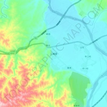
Name: 三滩镇 topographic map, elevation, terrain.
Location: 三滩镇, 靖远县, 白银市, 甘肃省, 中国 (36.64858 104.62951 36.72858 104.70951)
Average elevation: 4,728 ft
Minimum elevation: 4,505 ft
Maximum elevation: 5,344 ft
Other topographic maps
Click on a map to view its topography, its elevation and its terrain.