Geolocate

五合镇 topographic map

Interactive map

Click on the map to display elevation.

About this map

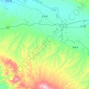
Name: 五合镇 topographic map, elevation, terrain.

Location: 五合镇, 靖远县, 白银市, 甘肃省, 中国 (36.74739 104.96146 37.01764 105.18775)

Average elevation: 6,191 ft

Minimum elevation: 5,361 ft

Maximum elevation: 8,596 ft

Other topographic maps

Click on a map to view its topography, its elevation and its terrain.

北滩

中国 > 甘肃省 > 靖远县

北滩, 靖远县, 白银市, 甘肃省, 中国

Average elevation: 5,335 ft

靖远县

中国 > 甘肃省 > 靖远县

靖远县, 白银市, 甘肃省, 中国

Average elevation: 5,135 ft

三滩镇

中国 > 甘肃省 > 靖远县

三滩镇, 靖远县, 白银市, 甘肃省, 中国

Average elevation: 4,728 ft

刘川镇

中国 > 甘肃省 > 靖远县

刘川镇, 靖远县, 白银市, 甘肃省, 中国

Average elevation: 5,348 ft

北滩镇

中国 > 甘肃省 > 靖远县

北滩镇, 靖远县, 白银市, 甘肃省, 中国

Average elevation: 5,502 ft

驼梁

中国 > 甘肃省 > 靖远县 > 东升镇 > 驼梁

驼梁, 东升镇, 靖远县, 白银市, 甘肃省, 中国

Average elevation: 5,925 ft