Geolocate

Millet Point topographic map

Click on the map to display elevation.

About this map

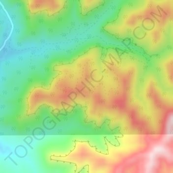
Name: Millet Point topographic map, elevation, terrain.

Location: Millet Point, Kane County, Utah, United States (37.40660 -112.78443 37.40670 -112.78433)

Average elevation: 6,913 ft

Minimum elevation: 6,352 ft

Maximum elevation: 7,621 ft

Kane County trails, hiking, mountain biking, running and outdoor activities

Other topographic maps

Click on a map to view its topography, its elevation and its terrain.

Kanab

United States > Utah > Kane County

Average elevation: 5,135 ft

Alton

United States > Utah > Kane County

Average elevation: 7,060 ft

Orderville

United States > Utah > Kane County

Average elevation: 5,997 ft

Big Water

United States > Utah > Kane County

Average elevation: 4,209 ft

Kanab

United States > Utah > Kane County

Average elevation: 5,135 ft

Orderville

United States > Utah > Kane County

Average elevation: 5,997 ft

Kanab

United States > Utah > Kane County

Average elevation: 5,135 ft

Orderville

United States > Utah > Kane County

Average elevation: 5,997 ft

Gear up for your next adventure:

🌲Outdoor Survival Books - Best books on survival skills
🧢Outdoor Hiking Hat - Sun protection hat for outdoor explorers
🧯Portable Fire Pit - Compact fire pit for camping spots
🪑Portable Camp Table - Compact table for campsite meals
🗻Climbing Gear Basics - Essential gear for beginner climbers

As an Amazon Associate, this site earns from qualifying purchases at no extra cost to you.