
Make a donation
Gear up for your next adventure:
As an Amazon Associate, this site earns from qualifying purchases at no extra cost to you.
Onyx topographic map
Click on the map to display elevation.
Make a donation
Gear up for your next adventure:
As an Amazon Associate, this site earns from qualifying purchases at no extra cost to you.
Onyx
Onyx (formerly, Scodie) is a census-designated place (CDP) in Kern County, California, United States. Onyx is located 3.5 miles (6 km) east-northeast of Weldon in the South Fork Valley at an elevation of 2,795 feet (852 m). The population was 457 at the 2020 census, down from 475 at the 2010 census.
Make a donation
Gear up for your next adventure:
As an Amazon Associate, this site earns from qualifying purchases at no extra cost to you.
About this map
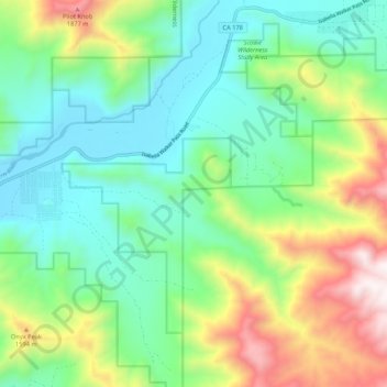
Name: Onyx topographic map, elevation, terrain.
Location: Onyx, Kern County, California, 93255, United States (35.65672 -118.26758 35.71802 -118.16112)
Average elevation: 3,953 ft
Minimum elevation: 2,707 ft
Maximum elevation: 6,749 ft
Kern County trails, hiking, mountain biking, running and outdoor activities
Make a donation
Gear up for your next adventure:
As an Amazon Associate, this site earns from qualifying purchases at no extra cost to you.
Other topographic maps
Click on a map to view its topography, its elevation and its terrain.
Bakersfield
United States > California > Kern County
Most of Bakersfield's major streets are six-lane divided roads with bike lanes, with almost every street in the city having proper lane signage for bicycle traffic. Bikes are a popular method of transportation in Bakersfield, due to the city's relatively flat topography and grid-like street system. Newer…
Average elevation: 515 ft
Bear Valley Springs
United States > California > Kern County
Bear Valley Springs is a guarded-gate community in Kern County, California, United States. Bear Valley Springs is in the Tehachapi Mountains and is part of the greater Tehachapi area. The elevation ranges from 4,121 feet (1,256 m) to 6,934 feet (2,113 m) (Bear Mountain). The population fluctuates between a low…
Average elevation: 3,950 ft
Lebec
United States > California > Kern County
According to the United States Census Bureau, Lebec has an area of 15.3 square miles (40 km2). The community, which is near Tejon Pass, lies at an elevation of 3,481 feet (1,061 m).
Average elevation: 3,812 ft
Make a donation
Gear up for your next adventure:
As an Amazon Associate, this site earns from qualifying purchases at no extra cost to you.
Tehachapi
United States > California > Kern County
Tehachapi (/təˈhætʃəpi/ (listen); Kawaiisu: Tihachipia, meaning "hard climb") is a city in Kern County, California, United States, in the Tehachapi Mountains, at an elevation of 3,970 feet (1,210 m), between the San Joaquin Valley and the Mojave Desert. Tehachapi is 35 miles (56 km) east-southeast of…
Average elevation: 4,639 ft
Rosamond
United States > California > Kern County > Rosamond
Rosamond sits in the northern end of the Antelope Valley, the westernmost valley of the Mojave Desert. Because the elevation is 2,000 to 3,000 feet (610 to 910 m) above sea level, the area, like the other parts of the Mojave Desert region, is referred to as the High Desert. Some cities and communities within…
Average elevation: 2,457 ft
Wofford Heights
United States > California > Kern County > Wofford Heights
Wofford Heights is a census-designated place (CDP) in the southern Sierra Nevada, in Kern County, California, United States. Wofford Heights is located in the west Kern River Valley, 3.5 miles (5.6 km) south-southwest of Kernville, at an elevation of 2,684 feet (818 m). The population was 2,200 at the 2010…
Average elevation: 3,665 ft
Make a donation
Gear up for your next adventure:
As an Amazon Associate, this site earns from qualifying purchases at no extra cost to you.
Bitter Creek National Wildlife Refuge
United States > California > Kern County
Average elevation: 3,136 ft
Bodfish
United States > California > Kern County > Bodfish
Bodfish is located 32 miles (51 km) east-northeast of Bakersfield, at an elevation of 2,687 feet (819 m).
Average elevation: 3,809 ft
Make a donation
Gear up for your next adventure:
As an Amazon Associate, this site earns from qualifying purchases at no extra cost to you.
Frazier Park
United States > California > Kern County
Frazier Park is an unincorporated community in Kern County, California. It is 5 miles (8 km) west of Lebec, at an elevation of 4,639 feet (1,414 m). It is one of the Mountain Communities of the Tejon Pass. The population was 2,691 in the 2010 census, up from 2,348 in 2000.
Average elevation: 5,030 ft
Ridgecrest
United States > California > Kern County
Walker Pass (elevation 5,250 ft (1.60 km)) is a mountain pass by Lake Isabella in the southern Sierra Nevada mountains. It is located in northeastern Kern County, approximately 53 mi (85 km) ENE of Bakersfield and 10 mi (16 km) WSW of Ridgecrest. The pass provides a route between the San Joaquin Valley on the…
Average elevation: 2,425 ft
Make a donation
Gear up for your next adventure:
As an Amazon Associate, this site earns from qualifying purchases at no extra cost to you.
Delano
United States > California > Kern County
Delano (/dəˈleɪnoʊ/ də-LAY-noh) is a city in Kern County, California, United States. Delano is located 31 miles (50 km) north-northwest of Bakersfield at an elevation of 315 feet (96 m). The population was 51,428 in 2020, down from 53,041 in 2010. It is Kern County's second-largest city after Bakersfield.
Average elevation: 325 ft
Taft
United States > California > Kern County
Taft (formerly Moron, Moro, and Siding Number Two) is a city in the foothills at the extreme southwestern edge of the San Joaquin Valley, in Kern County, California. Taft is located 32 miles (51 km) west-southwest of Bakersfield, at an elevation of 955 feet (291 m). The population was 9,327 at the 2010 census.…
Average elevation: 1,214 ft
Keene
United States > California > Kern County
Keene (formerly, Wells) is a census-designated place (CDP) in Kern County, California in the foothills of the Tehachapi Mountains at the southern extreme of the San Joaquin Valley. Keene is located 8.5 miles (14 km) northwest of Tehachapi, at an elevation of 2,602 feet (793 m). The population was 469 at the…
Average elevation: 2,927 ft
Make a donation
Gear up for your next adventure:
As an Amazon Associate, this site earns from qualifying purchases at no extra cost to you.
Boron
United States > California > Kern County
Boron (formerly Amargo, Baker, Borate, and Kern) is a unincorporated place in Kern County, California, United States. Boron is 15 miles (24 km) southwest of Red Rock Mountain at an elevation of 2,467 feet (752 m). For statistical purposes, the United States Census Bureau has defined Boron as a…
Average elevation: 2,470 ft
Kernville
United States > California > Kern County > Kernville
Kernville is a census-designated place (CDP) in the southern Sierra Nevada, in Kern County, California, United States. Kernville is located 42 miles (68 km) northeast of Bakersfield, at an elevation of 2,667 feet (813 m). The population was 1,549 at the 2020 United States census, up from 1,395 at the 2010…
Average elevation: 3,724 ft
Make a donation
Gear up for your next adventure:
As an Amazon Associate, this site earns from qualifying purchases at no extra cost to you.
Lake Isabella
United States > California > Kern County > Lake Isabella
The town of Lake Isabella is located 35 miles (56 km) east-northeast of Bakersfield, at an elevation of 2,513 feet (766 m). The population was 3,573 at the 2020 census, up from 3,466 at the 2010 census.
Average elevation: 3,261 ft
Lost Hills
United States > California > Kern County > Lost Hills
Lost Hills (formerly, Lost Hill) is an unincorporated community in Kern County, California, United States. Lost Hills is located 42 miles (68 km) west-northwest of Bakersfield, at an elevation of 305 feet (93 m). For statistical purposes, the United States Census Bureau has defined Lost Hills as a…
Average elevation: 269 ft
Mojave
United States > California > Kern County
Mojave (formerly Mohave) is an unincorporated community in Kern County, California, United States. Mojave is located 50 miles (80 km) east of Bakersfield, and 100 miles (161 km) north of Los Angeles, at an elevation of 2,762.46 feet (842.00 m). The town is located in the western region of the Mojave Desert,…
Average elevation: 2,877 ft
Make a donation
Gear up for your next adventure:
As an Amazon Associate, this site earns from qualifying purchases at no extra cost to you.
McFarland
United States > California > Kern County
McFarland (formerly, Hunt and Lone Pine) is a city in the San Joaquin Valley, in Kern County, California, United States. It is located 25 miles (40 km) northwest of Bakersfield and 6.5 miles (10 km) south of Delano, at an elevation of 354 feet (108 m). The population of McFarland was 14,161 at the 2020 census,…
Average elevation: 364 ft
Tehachapi
United States > California > Kern County
Tehachapi (/təˈhætʃəpi/ (listen); Kawaiisu: Tihachipia, meaning "hard climb") is a city in Kern County, California, United States, in the Tehachapi Mountains, at an elevation of 3,970 feet (1,210 m), between the San Joaquin Valley and the Mojave Desert. Tehachapi is 35 miles (56 km) east-southeast of…
Average elevation: 4,639 ft
Arvin
United States > California > Kern County
Arvin is a city in Kern County, California. Arvin is located 15 miles (24 km) southeast of Bakersfield, at an elevation of 449 feet (137 m). As of the 2010 census, the population was 19,304, up from 12,956 at the 2000 census.
Average elevation: 427 ft
Make a donation
Gear up for your next adventure:
As an Amazon Associate, this site earns from qualifying purchases at no extra cost to you.
Mojave
United States > California > Kern County
Mojave (formerly Mohave) is an unincorporated community in Kern County, California, United States. Mojave is located 50 miles (80 km) east of Bakersfield, and 100 miles (161 km) north of Los Angeles, at an elevation of 2,762 feet (842 m). The town is located in the western region of the Mojave Desert, below…
Average elevation: 2,877 ft
Frazier Park
United States > California > Kern County
Frazier Park is an unincorporated community and census-designated place in Kern County, California. It is 5 miles (8 km) west of Lebec, at an elevation of 4,639 feet (1,414 m). It is one of the Mountain Communities of the Tejon Pass. The population was 2,592 in the 2020 census, down from 2,691 in 2010.
Average elevation: 5,030 ft
McFarland
United States > California > Kern County
McFarland (formerly, Hunt and Lone Pine) is a city in the San Joaquin Valley, in Kern County, California, United States. McFarland is located 25 miles (40 km) north-northwest of Bakersfield and 6.5 miles (10 km) south of Delano, at an elevation of 354 feet (108 m). The population of McFarland was 12,707 at the…
Average elevation: 364 ft
Make a donation
Gear up for your next adventure:
As an Amazon Associate, this site earns from qualifying purchases at no extra cost to you.
Bakersfield
United States > California > Kern County
Most of Bakersfield's major streets are six-lane divided roads with bike lanes, with most streets in the city having proper lane signage for bicycle traffic but little to no protection from vehicle traffic. Despite the city's relatively flat topography and grid-like street system, only around 2,782 bike…
Average elevation: 515 ft
Tehachapi
United States > California > Kern County
Tehachapi (/təˈhætʃəpi/ ; Kawaiisu: Tihachipia, meaning "hard climb") is a city in Kern County, California, United States, in the Tehachapi Mountains, at an elevation of 3,970 feet (1,210 m), between the San Joaquin Valley and the Mojave Desert. Tehachapi is 35 miles (56 km) east-southeast of Bakersfield,…
Average elevation: 4,639 ft
Make a donation
Gear up for your next adventure:
As an Amazon Associate, this site earns from qualifying purchases at no extra cost to you.
Alta Sierra
United States > California > Kern County
Alta Sierra was laid out by property developers in the 1960s. Alta Sierra is a golf course community, with homes built around the Alta Sierra Country Club, a semi-private 18 hole course built in 1964. The community has a member-owned airport with a 2800-foot runway. The community is located just east of…
Average elevation: 5,997 ft
Mojave
United States > California > Kern County
Mojave (formerly Mohave) is an unincorporated community in Kern County, California, United States. Mojave is located 50 miles (80 km) east of Bakersfield, and 100 miles (161 km) north of Los Angeles, at an elevation of 2,762 feet (842 m). The town is located in the western region of the Mojave Desert, below…
Average elevation: 2,812 ft
Make a donation
Gear up for your next adventure:
As an Amazon Associate, this site earns from qualifying purchases at no extra cost to you.
Maricopa
United States > California > Kern County
Maricopa is a city in Kern County, California. Maricopa is located 6.5 miles (10 km) south-southeast of Taft, at an elevation of 883 feet (269 m). The population was 1,154 at the 2010 census, up from 1,111 at the 2000 census. The Carrizo Plain is located to the northwest, and the enormous Midway-Sunset Oil…
Average elevation: 912 ft
Kernville
United States > California > Kern County > Kernville
Kernville is a census-designated place (CDP) in the southern Sierra Nevada, in Kern County, California, United States. Kernville is located 42 miles (68 km) northeast of Bakersfield, at an elevation of 2,667 feet (813 m). The population was 1,549 at the 2020 United States census, up from 1,395 at the 2010…
Average elevation: 3,724 ft
Make a donation
Gear up for your next adventure:
As an Amazon Associate, this site earns from qualifying purchases at no extra cost to you.
Bakersfield
United States > California > Kern County
Most of Bakersfield's major streets are six-lane divided roads with bike lanes, with most streets in the city having proper lane signage for bicycle traffic but little to no protection from vehicle traffic. Despite the city's relatively flat topography and grid-like street system, only around 2,782 bike…
Average elevation: 515 ft
Woodford
United States > California > Kern County
Keene (formerly, Wells) is a census-designated place (CDP) in Kern County, California in the foothills of the Tehachapi Mountains at the southern extreme of the San Joaquin Valley. Keene is located 8.5 miles (14 km) northwest of Tehachapi, at an elevation of 2,602 feet (793 m). The population was 469 at the…
Average elevation: 2,949 ft
Make a donation
Gear up for your next adventure:
As an Amazon Associate, this site earns from qualifying purchases at no extra cost to you.
Miracle Hot Springs
United States > California > Kern County > Bodfish > Miracle Hot Springs
Average elevation: 2,818 ft
Make a donation
Gear up for your next adventure:
As an Amazon Associate, this site earns from qualifying purchases at no extra cost to you.
Arvin
United States > California > Kern County
Arvin is a city in Kern County, California. Arvin is located 15 miles (24 km) southeast of Bakersfield, at an elevation of 449 feet (137 m). As of the 2010 census, the population was 19,304, up from 12,956 at the 2000 census.
Average elevation: 427 ft
Make a donation
Gear up for your next adventure:
As an Amazon Associate, this site earns from qualifying purchases at no extra cost to you.
Lake Isabella
United States > California > Kern County > Lake Isabella
The town of Lake Isabella is located 35 miles (56 km) east-northeast of Bakersfield, at an elevation of 2,513 feet (766 m). The population was 3,466 at the 2010 census, up from 3,315 at the 2000 census.
Average elevation: 3,261 ft
Make a donation
Gear up for your next adventure:
As an Amazon Associate, this site earns from qualifying purchases at no extra cost to you.
Frazier Park
United States > California > Kern County
Frazier Park is a village and unincorporated community in Kern County, California. It is 5 miles (8 km) west of Lebec, at an elevation of 4,639 feet (1,414 m). It is one of the Mountain Communities of the Tejon Pass. The population was 2,592 in the 2020 census, down from 2,691 in 2010.
Average elevation: 5,030 ft
Wofford Heights
United States > California > Kern County > Wofford Heights
Wofford Heights is a census-designated place (CDP) in the southern Sierra Nevada, in Kern County, California, United States. Wofford Heights is located in the west Kern River Valley, 3.5 miles (5.6 km) south-southwest of Kernville, at an elevation of 2,684 feet (818 m). The population was 2,213 at the 2020…
Average elevation: 3,665 ft
Bakersfield
United States > California > Kern County
Most of Bakersfield's major streets are six-lane divided roads with bike lanes, with most streets in the city having proper lane signage for bicycle traffic but little to no protection from vehicle traffic. Despite the city's relatively flat topography and grid-like street system, only around 2,782 bike…
Average elevation: 515 ft
Make a donation
Gear up for your next adventure:
As an Amazon Associate, this site earns from qualifying purchases at no extra cost to you.
Taft
United States > California > Kern County
Taft (formerly Moron, Moro, and Siding Number Two) is a city in the foothills at the extreme southwestern edge of the San Joaquin Valley, in Kern County, California. Taft is located 32 miles (51 km) west-southwest of Bakersfield, at an elevation of 955 feet (291 m). The population was 8,546 at the 2020 census.…
Average elevation: 1,214 ft
Bakersfield
United States > California > Kern County
Most of Bakersfield's major streets are six-lane divided roads with bike lanes, with most streets in the city having proper lane signage for bicycle traffic but little to no protection from vehicle traffic. Despite the city's relatively flat topography and grid-like street system, only around 2,782 bike…
Average elevation: 515 ft
Bodfish
United States > California > Kern County > Bodfish
Bodfish is located 32 miles (51 km) east-northeast of Bakersfield, at an elevation of 2,687 feet (819 m).
Average elevation: 3,809 ft
Make a donation
Gear up for your next adventure:
As an Amazon Associate, this site earns from qualifying purchases at no extra cost to you.
Wasco
United States > California > Kern County
Wasco (formerly, Dewey and Deweyville) is a city in the San Joaquin Valley, in Kern County, California, United States. Wasco is located 24 miles (39 km) northwest of Bakersfield, at an elevation of 328 feet (100 m). The population was 25,545 at the 2010 census, up from 21,263 at the 2000 census.
Average elevation: 331 ft
Tehachapi
United States > California > Kern County
Tehachapi (/təˈhætʃəpi/ (listen); Kawaiisu: Tihachipia, meaning "hard climb")[9][10] is a city in Kern County, California, in the Tehachapi Mountains, at an elevation of 3,970 feet (1,210 m),[6] between the San Joaquin Valley and the Mojave Desert. Tehachapi is 35 miles (56 km) east-southeast of…
Average elevation: 4,639 ft
Make a donation
Gear up for your next adventure:
As an Amazon Associate, this site earns from qualifying purchases at no extra cost to you.
Rosamond
United States > California > Kern County
Rosamond sits in the northern end of the Antelope Valley, the westernmost valley of the Mojave Desert. Because the elevation is 2,000 to 3,000 feet (610 to 910 m) above sea level, the area, like the other parts of the Mojave Desert region, is referred to as the High Desert. Some cities and communities within…
Average elevation: 2,457 ft
Make a donation
Gear up for your next adventure:
As an Amazon Associate, this site earns from qualifying purchases at no extra cost to you.
Bakersfield
United States > California > Kern County
Most of Bakersfield's major streets are six-lane divided roads with bike lanes, with almost every street in the city having proper lane signage for bicycle traffic. Bicycles are a popular mode of transportation in Bakersfield, due to the city's relatively flat topography and grid-like street system. Newer…
Average elevation: 515 ft
Lake Isabella
United States > California > Kern County > Lake Isabella
The town of Lake Isabella is located 35 miles (56 km) east-northeast of Bakersfield,[5] at an elevation of 2,513 feet (766 m).[4] The population was 3,466 at the 2010 census, up from 3,315 at the 2000 census.
Average elevation: 3,261 ft
Make a donation
Gear up for your next adventure:
As an Amazon Associate, this site earns from qualifying purchases at no extra cost to you.
Taft
United States > California > Kern County
Taft (formerly Moron, Moro, and Siding Number Two)[9] is a city in the foothills at the extreme southwestern edge of the San Joaquin Valley, in Kern County, California. Taft is located 32 miles (51 km) west-southwest of Bakersfield,[9] at an elevation of 955 feet (291 m).[7] The population was 9,327 at the…
Average elevation: 1,214 ft
Make a donation
Gear up for your next adventure:
As an Amazon Associate, this site earns from qualifying purchases at no extra cost to you.
Buttonwillow
United States > California > Kern County > Buttonwillow
Buttonwillow is an unincorporated community and census-designated place in the San Joaquin Valley, in Kern County, California. Buttonwillow is 26 miles (42 km) west of Bakersfield, at an elevation of 269 feet (82 m)). The population was 1,508 at the 2010 census, up from 1,266 at the 2000 census. The center of…
Average elevation: 285 ft
Make a donation
Gear up for your next adventure:
As an Amazon Associate, this site earns from qualifying purchases at no extra cost to you.