
Dongola topographic map
Interactive map
Click on the map to display elevation.
About this map
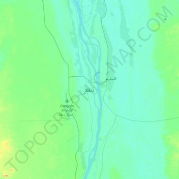
Name: Dongola topographic map, elevation, terrain.
Location: Dongola, Norden, Sudan (19.01285 30.31316 19.33285 30.63316)
Average elevation: 774 ft
Minimum elevation: 719 ft
Maximum elevation: 1,083 ft
Other topographic maps
Click on a map to view its topography, its elevation and its terrain.
Lake Nasser
Sudan > Norden > Wadi Halfa
Lake Nasser, أ 1, Wadi Halfa, Norden, Sudan
Average elevation: 597 ft