
卡坝乡 topographic map
Interactive map
Click on the map to display elevation.
About this map
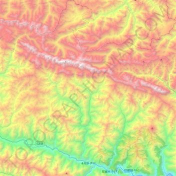
Name: 卡坝乡 topographic map, elevation, terrain.
Location: 卡坝乡, 迭部县, 甘南藏族自治州, 甘肃省, 中国 (33.95069 103.35862 34.31900 103.61106)
Average elevation: 10,843 ft
Minimum elevation: 6,424 ft
Maximum elevation: 15,771 ft
Other topographic maps
Click on a map to view its topography, its elevation and its terrain.