
扎尕那 topographic map
Interactive map
Click on the map to display elevation.
About this map
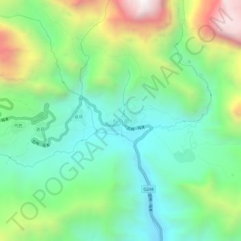
Name: 扎尕那 topographic map, elevation, terrain.
Location: 扎尕那, 迭部县, 甘南藏族自治州, 甘肃省, 中国 (34.21843 103.16752 34.25843 103.20752)
Average elevation: 10,673 ft
Minimum elevation: 9,232 ft
Maximum elevation: 13,688 ft
Other topographic maps
Click on a map to view its topography, its elevation and its terrain.