Geolocate

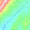
Glasgow topographic map

Click on the map to display elevation.

About this map
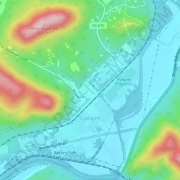
Name: Glasgow topographic map, elevation, terrain.

Location: Glasgow, Rockbridge County, Virginia, United States (37.62361 -79.47351 37.65408 -79.43361)

Average elevation: 932 ft

Minimum elevation: 692 ft

Maximum elevation: 1,640 ft

Rockbridge County trails, hiking, mountain biking, running and outdoor activities

Other topographic maps

Click on a map to view its topography, its elevation and its terrain.
East Lexington

United States > Virginia > Rockbridge County

Average elevation: 1,033 ft

Zack

United States > Virginia > Rockbridge County

Average elevation: 1,778 ft

Wilson Springs

United States > Virginia > Rockbridge County

Average elevation: 1,627 ft

Vesuvius

United States > Virginia > Rockbridge County

Average elevation: 1,726 ft

Oakdale

United States > Virginia > Rockbridge County

Average elevation: 1,421 ft

Fairfield

United States > Virginia > Rockbridge County

Average elevation: 1,670 ft

Gear up for your next adventure:

📶Vehicle Signal Boosters - Improve reception in rural areas while driving to trailheads
🥄Camping Utensil Set - Lightweight utensils for outdoor meals
🏕️Tent Footprint - Protect your tent base from wear
📚USA Hiking Guide Books - Top trail guides and map books
🪑Ultralight Camp Chairs - Portable seating for resting after a long day of mapping

As an Amazon Associate, this site earns from qualifying purchases at no extra cost to you.