
甘加镇 topographic map
Interactive map
Click on the map to display elevation.
About this map
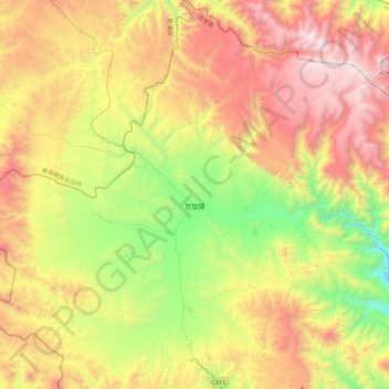
Name: 甘加镇 topographic map, elevation, terrain.
Location: 甘加镇, 夏河县, 甘南藏族自治州, 甘肃省, 中国 (35.23367 102.27732 35.58838 102.70649)
Average elevation: 11,417 ft
Minimum elevation: 8,366 ft
Maximum elevation: 15,187 ft
Other topographic maps
Click on a map to view its topography, its elevation and its terrain.