Geolocate

Mexican Hat topographic map

Click on the map to display elevation.

About this map

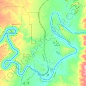
Name: Mexican Hat topographic map, elevation, terrain.

Location: Mexican Hat, San Juan County, Utah, United States (37.14424 -109.91093 37.20026 -109.82930)

Average elevation: 4,416 ft

Minimum elevation: 4,022 ft

Maximum elevation: 5,217 ft

San Juan County trails, hiking, mountain biking, running and outdoor activities

Other topographic maps

Click on a map to view its topography, its elevation and its terrain.

Valley of the Gods

United States > Utah > San Juan County

Average elevation: 4,603 ft

Slickhorn Canyon

United States > Utah > San Juan County

Average elevation: 5,725 ft

Allen Canyon

United States > Utah > San Juan County

Average elevation: 6,398 ft

White Canyon

United States > Utah > San Juan County

Average elevation: 6,040 ft

Beef Basin Wash

United States > Utah > San Juan County

Average elevation: 6,850 ft

Red Canyon

United States > Utah > San Juan County

Average elevation: 4,852 ft

Bullet Canyon

United States > Utah > San Juan County

Average elevation: 6,211 ft

Kane Gulch

United States > Utah > San Juan County

Average elevation: 6,480 ft

Island in the Sky

United States > Utah > San Juan County

Average elevation: 5,919 ft

Abajo Mountains

United States > Utah > San Juan County

Average elevation: 9,429 ft

Gear up for your next adventure:

🏫Relief Map Kits - Hands-on tools for teaching landforms and elevation
🪶Trail Camera - Capture wildlife on your hikes
🔥Camping Stove - Portable stove for camping and backcountry cooking
🏥Hiking First Aid Kits - Comprehensive medical kits for remote trail injuries
🔭Stargazing Telescopes - Perfect for camping in low-light pollution areas shown on maps

As an Amazon Associate, this site earns from qualifying purchases at no extra cost to you.