
Make a donation
Gear up for your next adventure:
As an Amazon Associate, this site earns from qualifying purchases at no extra cost to you.
Valley of the Gods topographic map
Click on the map to display elevation.
Make a donation
Gear up for your next adventure:
As an Amazon Associate, this site earns from qualifying purchases at no extra cost to you.
About this map
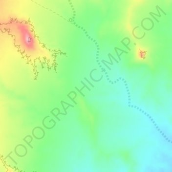
Name: Valley of the Gods topographic map, elevation, terrain.
Location: Valley of the Gods, San Juan County, Utah, United States (37.23272 -109.87033 37.25272 -109.85033)
Average elevation: 4,603 ft
Minimum elevation: 4,442 ft
Maximum elevation: 4,902 ft
San Juan County trails, hiking, mountain biking, running and outdoor activities
Make a donation
Gear up for your next adventure:
As an Amazon Associate, this site earns from qualifying purchases at no extra cost to you.
Other topographic maps
Click on a map to view its topography, its elevation and its terrain.
Lake Powell
United States > Utah > San Juan County
Concrete placement started around the clock on June 17, 1960. The last bucket of concrete was poured on September 13, 1963. Over 5 million cubic yards (4,000,000 m³) of concrete make up Glen Canyon Dam. The dam is 710 feet (216 m) high and the surface elevation of the water at full-pool is approximately 3700…
Average elevation: 5,102 ft
Make a donation
Gear up for your next adventure:
As an Amazon Associate, this site earns from qualifying purchases at no extra cost to you.
Oljato–Monument Valley
United States > Utah > San Juan County
Oljato–Monument Valley is located at 37°0′38″N 110°14′34″W / 37.01056°N 110.24278°W / 37.01056; -110.24278 (37.010556, -110.242778), at an elevation of 1,475 m (4,840 feet).
Average elevation: 5,108 ft
Make a donation
Gear up for your next adventure:
As an Amazon Associate, this site earns from qualifying purchases at no extra cost to you.
Monticello
United States > Utah > San Juan County
Monticello is located at the base of the Abajo Mountains, or the Blue Mountains, which are part of the Manti-La Sal National Forest. The elevation of Monticello is 7,069 feet (2,155 m). From Monticello, a tree formation on the Blue Mountains can be seen, which resembles a horse's head and neck, which can be…
Average elevation: 7,037 ft
Make a donation
Gear up for your next adventure:
As an Amazon Associate, this site earns from qualifying purchases at no extra cost to you.
Make a donation
Gear up for your next adventure:
As an Amazon Associate, this site earns from qualifying purchases at no extra cost to you.
Fish Creek Canyon Wilderness Study Area
United States > Utah > San Juan County
Average elevation: 5,961 ft