Geolocate

Red Canyon topographic map

Click on the map to display elevation.

About this map

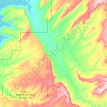
Name: Red Canyon topographic map, elevation, terrain.

Location: Red Canyon, San Juan County, Utah, United States (37.54560 -110.44505 37.71586 -110.28267)

Average elevation: 4,852 ft

Minimum elevation: 3,648 ft

Maximum elevation: 6,453 ft

San Juan County trails, hiking, mountain biking, running and outdoor activities

Other topographic maps

Click on a map to view its topography, its elevation and its terrain.

Lake Powell

United States > Utah > San Juan County

Concrete placement started around the clock on June 17, 1960. The last bucket of concrete was poured on September 13, 1963. Over 5 million cubic yards (4,000,000 m³) of concrete make up Glen Canyon Dam. The dam is 710 feet (216 m) high and the surface elevation of the water at full-pool is approximately 3700…

Average elevation: 5,102 ft

Monticello

United States > Utah > San Juan County

Monticello is located at the base of the Abajo Mountains, or the Blue Mountains, which are part of the Manti-La Sal National Forest. The elevation of Monticello is 7,069 feet (2,155 m). From Monticello, a tree formation on the Blue Mountains can be seen, which resembles a horse's head and neck, which can be…

Average elevation: 7,037 ft

Valley of the Gods

United States > Utah > San Juan County

Average elevation: 4,603 ft

Spanish Valley

United States > Utah > San Juan County

Average elevation: 5,604 ft

Oljato–Monument Valley

United States > Utah > San Juan County

Oljato–Monument Valley is located at 37°0′38″N 110°14′34″W / 37.01056°N 110.24278°W / 37.01056; -110.24278 (37.010556, -110.242778), at an elevation of 1,475 m (4,840 feet).

Average elevation: 5,108 ft

Mexican Hat

United States > Utah > San Juan County

Average elevation: 4,416 ft

La Sal

United States > Utah > San Juan County

Average elevation: 6,883 ft

Island in the Sky

United States > Utah > San Juan County

Average elevation: 5,919 ft

Abajo Mountains

United States > Utah > San Juan County

Average elevation: 9,429 ft

Gear up for your next adventure:

🦺Reflective Outdoor Gear - Safety gear for low‑light conditions
🎁Geography Themed Gifts - Unique gift ideas for map lovers and geography enthusiasts
🧯Portable Fire Pit - Compact fire pit for camping spots
🌧️Backpack Rain Cover - Keep gear dry in wet weather
🗺️Topographic Maps - Detailed topo maps for hiking, exploring and outdoor navigation

As an Amazon Associate, this site earns from qualifying purchases at no extra cost to you.