Geolocate

Fault topographic map

Click on the map to display elevation.

About this map

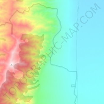
Name: Fault topographic map, elevation, terrain.

Location: Fault, Churchill County, Nevada, United States (39.54485 -118.20626 39.64547 -118.17230)

Average elevation: 4,925 ft

Minimum elevation: 3,501 ft

Maximum elevation: 8,747 ft

Churchill County trails, hiking, mountain biking, running and outdoor activities

Other topographic maps

Click on a map to view its topography, its elevation and its terrain.

Fallon Station

United States > Nevada > Churchill County

Average elevation: 3,940 ft

Desert

United States > Nevada > Churchill County > Fernley

Average elevation: 4,091 ft

Middlegate

United States > Nevada > Churchill County

Average elevation: 4,734 ft

Eastgate

United States > Nevada > Churchill County

Average elevation: 5,381 ft

Carson Sink

United States > Nevada > Churchill County

Average elevation: 4,101 ft

Gear up for your next adventure:

🔥Plasma Lighters - Windproof lighters that work in any weather condition
📚Navigation Handbooks - Master the art of reading topographic maps and using a compass
🚪Portable Camp Chair - Foldable chair for comfort at camp
🪶Wildlife Field Guides - Learn animal tracking and species ID
🛡️Bear Spray Outdoor - Protection in bear country hikes

As an Amazon Associate, this site earns from qualifying purchases at no extra cost to you.