
Carson Sink topographic map
Click on the map to display elevation.
About this map
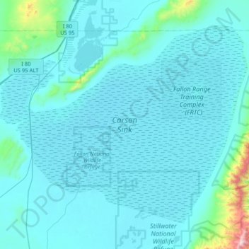
Name: Carson Sink topographic map, elevation, terrain.
Location: Carson Sink, Churchill County, Nevada, United States (39.62046 -118.85460 40.01023 -118.21955)
Average elevation: 4,101 ft
Minimum elevation: 3,858 ft
Maximum elevation: 8,694 ft
Churchill County trails, hiking, mountain biking, running and outdoor activities
Other topographic maps
Click on a map to view its topography, its elevation and its terrain.
Dixie Valley - Fairview Peak 7.1 Earthquake 1954 Fault Line
United States > Nevada > Churchill County
Average elevation: 5,961 ft