Geolocate

Muttukadu topographic map

Click on the map to display elevation.

About this map

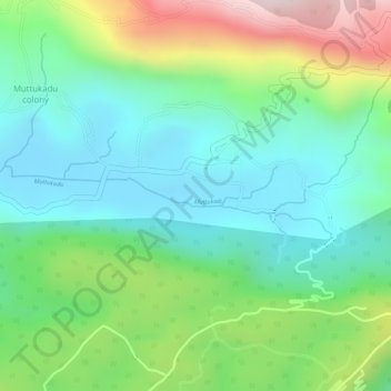
Name: Muttukadu topographic map, elevation, terrain.

Location: Muttukadu, Udumbanchola, Idukki, Kerala, 685619, India (10.00943 77.14592 10.01190 77.15863)

Average elevation: 3,596 ft

Minimum elevation: 3,087 ft

Maximum elevation: 4,606 ft

Other topographic maps

Click on a map to view its topography, its elevation and its terrain.

Nallathanni

India > Kerala > Idukki

Average elevation: 4,236 ft

Mali

India > Kerala > Idukki

Average elevation: 3,583 ft

Kunchithanny

India > Kerala > Idukki

Average elevation: 3,071 ft

Pettimudi Hill Top

India > Kerala > Idukki

Average elevation: 2,657 ft

Kokkayar

India > Kerala > Idukki

Average elevation: 512 ft

Kodathi

India > Kerala > Idukki

Average elevation: 285 ft

Peppara

India > Kerala > Idukki

Average elevation: 2,464 ft

Malankara Dam

India > Kerala > Idukki

Average elevation: 194 ft

Chokramudi

India > Kerala > Idukki

Average elevation: 5,479 ft

Gear up for your next adventure:

🧭Hiking Compass - Precision compass for reliable navigation in the wilderness
🗺️NatGeo Topo Maps - High-quality waterproof printed topographic maps of US Parks
GPS Sports Watch - GPS watch for running, hiking and training
🚪Portable Camp Chair - Foldable chair for comfort at camp
🪶Trail Camera - Capture wildlife on your hikes

As an Amazon Associate, this site earns from qualifying purchases at no extra cost to you.