
Ridgefield topographic map
Click on the map to display elevation.
About this map
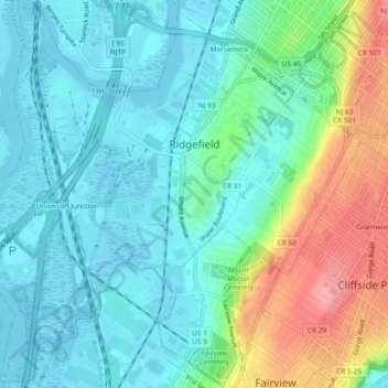
Name: Ridgefield topographic map, elevation, terrain.
Location: Ridgefield, Bergen County, New Jersey, United States (40.81272 -74.03538 40.84666 -73.98888)
Average elevation: 89 ft
Minimum elevation: -7 ft
Maximum elevation: 325 ft
Bergen County trails, hiking, mountain biking, running and outdoor activities
Other topographic maps
Click on a map to view its topography, its elevation and its terrain.
Wallington
United States > New Jersey > Bergen County > Wallington > Wallington
Average elevation: 75 ft
River Edge
United States > New Jersey > Bergen County > River Edge > River Edge
Average elevation: 69 ft
Warren Point
United States > New Jersey > Bergen County > Fair Lawn > Warren Point
Average elevation: 72 ft
New Bridge
United States > New Jersey > Bergen County > New Milford > New Bridge
Average elevation: 62 ft
Ridgefield
United States > New Jersey > Bergen County > Ridgefield > Ridgefield
Average elevation: 79 ft