
湖边镇 topographic map
Interactive map
Click on the map to display elevation.
About this map
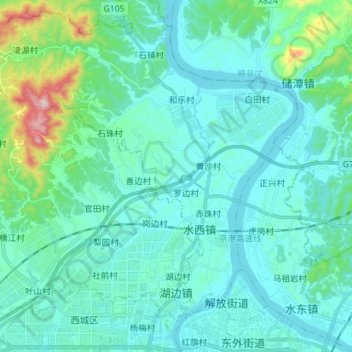
Name: 湖边镇 topographic map, elevation, terrain.
Location: 湖边镇, 赣州经济技术开发区, 章贡区, 赣州市, 江西省, 中国 (25.85972 114.77993 25.96434 114.92165)
Average elevation: 525 ft
Minimum elevation: 285 ft
Maximum elevation: 1,959 ft
Other topographic maps
Click on a map to view its topography, its elevation and its terrain.