Geolocate

Mathare topographic map

Click on the map to display elevation.

About this map

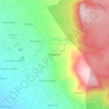
Name: Mathare topographic map, elevation, terrain.

Location: Mathare, Nakuru, Kenya (-0.23816 36.16181 -0.19816 36.20181)

Average elevation: 7,090 ft

Minimum elevation: 6,493 ft

Maximum elevation: 7,953 ft

Other topographic maps

Click on a map to view its topography, its elevation and its terrain.

Njoro

Kenya > Nakuru

Average elevation: 7,917 ft

Lake Naivasha

Kenya > Nakuru > Lake Naivasha Simba Lodge

Average elevation: 6,220 ft

Olkaria ward

Kenya > Nakuru > Naivasha

Average elevation: 6,388 ft

Gear up for your next adventure:

🧯Portable Fire Pit - Compact fire pit for camping spots
🧭Map Reading Tools - Tools and kits for map navigation
🧣Merino Neck Gaiters - Multi-functional headwear for wind and sun protection
🛡️Bear Spray Outdoor - Protection in bear country hikes
📶Satellite Messenger - Communication device off‑grid

As an Amazon Associate, this site earns from qualifying purchases at no extra cost to you.