
东江乡 topographic map
Interactive map
Click on the map to display elevation.
About this map
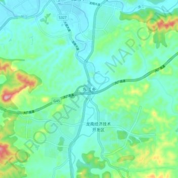
Name: 东江乡 topographic map, elevation, terrain.
Location: 东江乡, 龙南市, 赣州市, 江西省, 中国 (24.82372 114.76501 24.90372 114.84501)
Average elevation: 827 ft
Minimum elevation: 656 ft
Maximum elevation: 1,437 ft
Other topographic maps
Click on a map to view its topography, its elevation and its terrain.