Geolocate

Bashaw topographic map

Click on the map to display elevation.

About this map

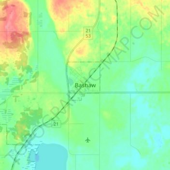
Name: Bashaw topographic map, elevation, terrain.

Location: Bashaw, Division No. 10, Alberta, T0B 0H0, Canada (52.54333 -113.00667 52.62333 -112.92667)

Average elevation: 2,612 ft

Minimum elevation: 2,546 ft

Maximum elevation: 2,776 ft

Other topographic maps

Click on a map to view its topography, its elevation and its terrain.

Village of Innisfree

Canada > Alberta > Division No. 10

Average elevation: 2,228 ft

Village of Bittern Lake

Canada > Alberta > Division No. 10

Average elevation: 2,448 ft

Village of Myrnam

Canada > Alberta > Division No. 10

Average elevation: 1,998 ft

Gear up for your next adventure:

📱Solar Portable Charger - Solar power bank for charging devices off‑grid
🧯Emergency Survival Kit - All‑in‑one survival essentials for the backcountry
🔭Telescopic Hiking Pole - Adjustable pole for hiking stability
🔋Solar Power Banks - Keep your GPS and phone charged in remote wilderness areas
👖Convertible Hiking Pants - Versatile zip-off pants for changing altitudes and temperatures

As an Amazon Associate, this site earns from qualifying purchases at no extra cost to you.