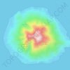
Gane Dalam topographic map
Click on the map to display elevation.
About this map

Name: Gane Dalam topographic map, elevation, terrain.
Location: Gane Dalam, North Maluku, Maluku, Indonesia (-0.83265 128.24062 -0.79265 128.28062)
Average elevation: 82 ft
Minimum elevation: 0 ft
Maximum elevation: 440 ft
Other topographic maps
Click on a map to view its topography, its elevation and its terrain.


Makian Island
Indonesia > North Maluku > Halmahera Selatan > Matsa (matan Tengin)
Average elevation: 807 ft