
Cambridge topographic map
Click on the map to display elevation.
About this map
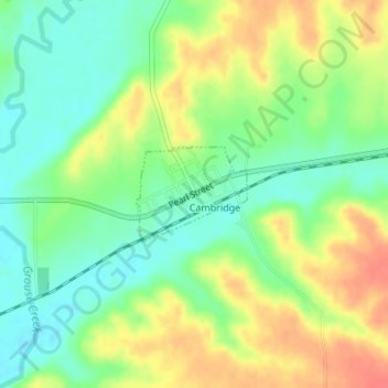
Name: Cambridge topographic map, elevation, terrain.
Location: Cambridge, Cowley County, Kansas, United States (37.31374 -96.67134 37.32038 -96.66164)
Average elevation: 1,302 ft
Minimum elevation: 1,224 ft
Maximum elevation: 1,401 ft
Cowley County trails, hiking, mountain biking, running and outdoor activities
Other topographic maps
Click on a map to view its topography, its elevation and its terrain.
Arkansas City
United States > Kansas > Cowley County > Arkansas City > Arkansas City
Average elevation: 1,112 ft