Geolocate

Chatawa topographic map

Click on the map to display elevation.

About this map

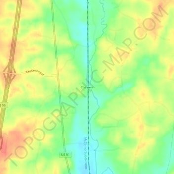
Name: Chatawa topographic map, elevation, terrain.

Location: Chatawa, Pike County, Mississippi, 39632, United States (31.04046 -90.49232 31.08046 -90.45232)

Average elevation: 308 ft

Minimum elevation: 220 ft

Maximum elevation: 390 ft

Pike County trails, hiking, mountain biking, running and outdoor activities

Other topographic maps

Click on a map to view its topography, its elevation and its terrain.

McComb

United States > Mississippi > Pike County

Average elevation: 413 ft

Magnolia

United States > Mississippi > Pike County

Average elevation: 344 ft

Summit

United States > Mississippi > Pike County

Average elevation: 433 ft

Gear up for your next adventure:

📖Nature Tracking Books - Learn to track wildlife and terrain
🎒Day Hiking Backpack - Lightweight backpack perfect for day trips and outdoor adventures
🛌Ultralight Sleeping Bags - Compact down bags for cold nights in the wilderness
🪶Multi‑Purpose Knife - Useful blade for camp and trail
🧭GPS Watch Accessories - Bands and chargers for GPS watches

As an Amazon Associate, this site earns from qualifying purchases at no extra cost to you.