
Hampton topographic map
Click on the map to display elevation.
About this map
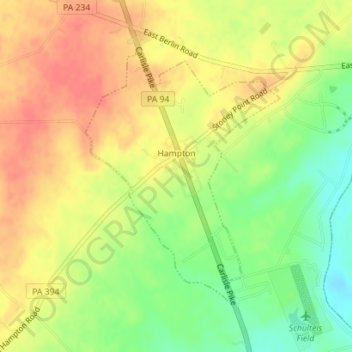
Name: Hampton topographic map, elevation, terrain.
Location: Hampton, Adams County, Pennsylvania, United States (39.91780 -77.06744 39.93764 -77.04796)
Average elevation: 515 ft
Minimum elevation: 413 ft
Maximum elevation: 591 ft
Adams County trails, hiking, mountain biking, running and outdoor activities
Other topographic maps
Click on a map to view its topography, its elevation and its terrain.
Cemetery Ridge
United States > Pennsylvania > Adams County > Cumberland Township
Average elevation: 545 ft
Wenksville
United States > Pennsylvania > Adams County > Menallen Township
Average elevation: 1,178 ft
Tartown
United States > Pennsylvania > Adams County > Hamiltonban Township
Average elevation: 1,483 ft
Two Taverns
United States > Pennsylvania > Adams County > Mount Joy Township
Average elevation: 548 ft
Iron Springs
United States > Pennsylvania > Adams County > Hamiltonban Township
Average elevation: 866 ft
Maria Furnace
United States > Pennsylvania > Adams County > Hamiltonban Township
Average elevation: 955 ft
Mount Tabor
United States > Pennsylvania > Adams County > Menallen Township
Average elevation: 1,001 ft
Bermudian Creek
United States > Pennsylvania > Adams County > Latimore Township
Average elevation: 545 ft
Graefenburg
United States > Pennsylvania > Adams County > Franklin Township
Average elevation: 1,283 ft
Greenmount
United States > Pennsylvania > Adams County > Cumberland Township
Average elevation: 495 ft
McKnightstown
United States > Pennsylvania > Adams County > Franklin Township
Average elevation: 633 ft
Cress Ridge
United States > Pennsylvania > Adams County > Mount Pleasant Township
Average elevation: 581 ft
Mount Hope
United States > Pennsylvania > Adams County > Hamiltonban Township
Average elevation: 1,296 ft