Withybrook CP topographic map
Interactive map
Click on the map to display elevation.
About this map
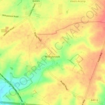
Name: Withybrook CP topographic map, elevation, terrain.
Location: Withybrook CP, Rugby, Warwickshire, England, United Kingdom (52.44227 -1.39100 52.47352 -1.31900)
Average elevation: 377 ft
Minimum elevation: 266 ft
Maximum elevation: 453 ft
Other topographic maps
Click on a map to view its topography, its elevation and its terrain.
Binley Woods CP
United Kingdom > England > Warwickshire > Rugby
Binley Woods CP, Rugby, Warwickshire, England, United Kingdom
Average elevation: 282 ft
Ryton Pools Country Park
United Kingdom > England > Warwickshire > Rugby
Ryton Pools Country Park, Ryton on Dunsmore CP, Rugby, Warwickshire, England, CV8 3BG, United Kingdom
Average elevation: 269 ft
Newbold on Avon
United Kingdom > England > Warwickshire > Rugby
Newbold on Avon, Rugby, Warwickshire, England, CV21 1HQ, United Kingdom
Average elevation: 322 ft
Churchover CP
United Kingdom > England > Warwickshire > Rugby
Churchover CP, Rugby, Warwickshire, England, United Kingdom
Average elevation: 377 ft
Ryton Wood
United Kingdom > England > Warwickshire > Rugby > Ryton-on-Dunsmore
Ryton Wood, Ryton on Dunsmore CP, Ryton-on-Dunsmore, Rugby, Warwickshire, England, United Kingdom
Average elevation: 292 ft
Monks Kirby CP
United Kingdom > England > Warwickshire > Rugby
Monks Kirby CP, Rugby, Warwickshire, England, United Kingdom
Average elevation: 384 ft
Harborough Magna CP
United Kingdom > England > Warwickshire > Rugby
Harborough Magna CP, Rugby, Warwickshire, England, United Kingdom
Average elevation: 348 ft
Draycote Water
United Kingdom > England > Warwickshire > Rugby > Draycote
Draycote Water, Draycote, Rugby, Warwickshire, England, United Kingdom
Average elevation: 302 ft
Thurlaston CP
United Kingdom > England > Warwickshire > Rugby
Thurlaston CP, Rugby, Warwickshire, England, United Kingdom
Average elevation: 322 ft
Church Lawford CP
United Kingdom > England > Warwickshire > Rugby
Church Lawford CP, Rugby, Warwickshire, England, United Kingdom
Average elevation: 322 ft
Wibtoft CP
United Kingdom > England > Warwickshire > Rugby > Wibtoft CP
Wibtoft CP, Rugby, Warwickshire, England, LE17 5BB, United Kingdom
Average elevation: 407 ft
Frankton CP
United Kingdom > England > Warwickshire > Rugby > Frankton CP
Frankton CP, Rugby, Warwickshire, England, United Kingdom
Average elevation: 312 ft
Dunchurch
United Kingdom > England > Warwickshire > Rugby
Dunchurch, Rugby, Warwickshire, England, United Kingdom
Average elevation: 335 ft
Wolvey CP
United Kingdom > England > Warwickshire > Rugby
Wolvey CP, Rugby, Warwickshire, England, United Kingdom
Average elevation: 371 ft
Barnacle
United Kingdom > England > Warwickshire > Rugby > Barnacle
Barnacle, Rugby, Warwickshire, West Midlands, England, CV7 9LE, United Kingdom
Average elevation: 335 ft
Bramcote
United Kingdom > England > Warwickshire > Rugby
Bramcote, Rugby, Warwickshire, England, CV11 6QX, United Kingdom
Average elevation: 344 ft
Newton
United Kingdom > England > Warwickshire > Rugby
Newton, Rugby, Warwickshire, England, CV23 0EE, United Kingdom
Average elevation: 374 ft
Draycote
United Kingdom > England > Warwickshire > Rugby
Draycote, Rugby, Warwickshire, England, CV23 9RB, United Kingdom
Average elevation: 308 ft
Bilton
United Kingdom > England > Warwickshire > Rugby
Bilton, Rugby, Warwickshire, England, CV22 7NL, United Kingdom
Average elevation: 364 ft
Long Lawford
United Kingdom > England > Warwickshire > Rugby
Long Lawford, Rugby, Warwickshire, England, CV23 9DA, United Kingdom
Average elevation: 312 ft
Wolston CP
United Kingdom > England > Warwickshire > Rugby > Wolston CP
Wolston CP, Rugby, Warwickshire, England, United Kingdom
Average elevation: 292 ft
Ryton-on-Dunsmore
United Kingdom > England > Warwickshire > Rugby
Ryton-on-Dunsmore, Rugby, Warwickshire, England, CV8 3EW, United Kingdom
Average elevation: 262 ft
Clifton upon Dunsmore CP
United Kingdom > England > Warwickshire > Rugby
Clifton upon Dunsmore CP, Rugby, Warwickshire, England, United Kingdom
Average elevation: 354 ft