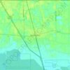
Independence topographic map
Click on the map to display elevation.
About this map

Name: Independence topographic map, elevation, terrain.
Location: Independence, Tangipahoa Parish, Louisiana, United States (30.62499 -90.52914 30.64999 -90.48922)
Average elevation: 79 ft
Minimum elevation: 56 ft
Maximum elevation: 98 ft
Tangipahoa Parish trails, hiking, mountain biking, running and outdoor activities
Other topographic maps
Click on a map to view its topography, its elevation and its terrain.
Ponchatoula
United States > Louisiana > Tangipahoa Parish > Ponchatoula > Ponchatoula
Ponchatoula is located at 30°26′21″N 90°26′33″W / 30.43917°N 90.44250°W / 30.43917; -90.44250 (30.439162, -90.442507) and has an elevation of 26 feet (7.9 m). According to the United States Census Bureau, the city has a total area of 4.2 square miles (11 km2), all land.
Average elevation: 23 ft