Geolocate

Magnolia topographic map

Click on the map to display elevation.

About this map

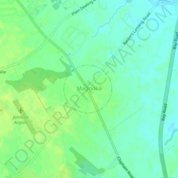
Name: Magnolia topographic map, elevation, terrain.

Location: Magnolia, Kent County, Delaware, United States (39.06778 -75.48068 39.07505 -75.47132)

Average elevation: 23 ft

Minimum elevation: -3 ft

Maximum elevation: 46 ft

Kent County trails, hiking, mountain biking, running and outdoor activities

Other topographic maps

Click on a map to view its topography, its elevation and its terrain.

Lebanon

United States > Delaware > Kent County > Highland Acres

Average elevation: 23 ft

Vernon

United States > Delaware > Kent County

Average elevation: 52 ft

Dover Base

United States > Delaware > Kent County

Average elevation: 16 ft

Lebanon

United States > Delaware > Kent County > Highland Acres

Average elevation: 23 ft

Holletts Corners

United States > Delaware > Kent County

Average elevation: 69 ft

Woodstock Court

United States > Delaware > Kent County > Dover

Average elevation: 43 ft

Marydel

United States > Delaware > Kent County

Average elevation: 62 ft

Lake Bernard

United States > Delaware > Kent County > Florence

Average elevation: 13 ft

Gear up for your next adventure:

🧭GPS Watch Accessories - Bands and chargers for GPS watches
🪶Survival Guide Book - Expert advice for emergency preparedness
🥾Hiking Shoes - Durable and comfortable shoes for trail hiking
📷Action Cameras - Rugged cameras to document your journeys across rugged terrain
🔥Fast-Boil Camping Stoves - Efficient cooking systems for quick trail meals

As an Amazon Associate, this site earns from qualifying purchases at no extra cost to you.